


Modern Avionics: EFIS vs Garmin GPS, which one to choose for your light aircraft
Categories :
BAYO
Introduction
The good weather is here: clear skies, 25°C, wind at 35 knots, a perfect forecast for flying with fellow VFR pilots. We head to the flying club, the one where it all started. Coffee, croissants shared, then straight to the aircraft. Headset on — H10-13.4 or A30 for those who prefer ANR — and flight plan in mind, ready to discover once again fascinating landscapes.
It’s when we settle into the cockpit that the thought comes back: what if we modernized all this? We dream of a clear display, accessible engine data, a real-time interactive map, a full view of the airspace…
Sure, we have a tablet, but it’s not enough. We want better, safer, more intuitive.
This is why we suggest taking a look at the differences between GPS and EFIS — and above all, how these systems can transform your flying experience.
But what exactly is an EFIS?
To give you the clearest and simplest definition: an EFIS is a digital screen that can replace the artificial horizon (the reference for the aircraft’s attitude), the airspeed indicator, the altimeter (which defines altitude above ground), the vertical speed indicator, and of course, the compass or heading indicator used to navigate. Sometimes it also includes a turn coordinator — which is the case on the G3X.
A valuable aid to make piloting easier
The EFIS doesn’t just replace needles; it interprets information logically and gives you fast, reliable decision-making. Unlike a tired gyroscope, data remains stable. The display adapts in real time to different flight contexts: some models switch automatically to night mode and warn of possible anomalies. Even the colors are carefully designed to guide you clearly.
Whether you’re flying VFR in beautiful weather or in more complex IFR conditions (only if the G3X is linked, for example, with a GNC 355 or a GNX 375 to obtain NAV/COM and ADS-B In/Out), it provides a fundamental safety advantage.
A fixed integration at the heart of the cockpit
Unlike portable GPS units such as the aera 660 or 760, which can be mounted with a suction cup, the EFIS is securely integrated into your dashboard and directly connected to sensors ranging from pitot tubes, airspeed sensors, magnetometers to the inertial unit, and more…
In other words, it is a core part of your aircraft or microlight, whether in the newest models (Fury M350, Vision Jet, or a Cruiser PS 28N) or in the modernization of older aircraft.
Focus on Garmin G5 and G3X Touch EFIS
Now that we understand the benefits of an EFIS in a modern cockpit, let’s get to the point: what does Garmin offer for microlight and general light aviation pilots?
Garmin G5: simplicity, efficiency, reliability
The G5 can be compared to the smartphone of flight instruments: compact, powerful, reliable, and above all more affordable than other expensive products.
It completely replaces the artificial horizon but can go further by integrating an HSI (Horizontal Situation Indicator). On non-certified aircraft, you’ll need two G5 units: one for the primary flight display, the other for the HSI, since it is not a true MFD (Multi-Function Display). Thanks to Garmin’s ecosystem, it integrates with many products such as the GNC 355 and GNX 375 to display navigation, and it can even connect to the GFC 500 autopilot for certified aircraft. For onboard safety, it features a backup battery with up to 4 hours of autonomy in case of electrical failure during flight.
This makes it ideal for high-end microlights, retrofits, and especially for pilots wanting a compact, clear, easy-to-install EFIS with a standard 3-1/8" cutout.
Garmin G3X Touch: the all-in-one, touchscreen, scalable EFIS
It provides both PFD and MFD on the same screen, meaning you only need one. It displays flight instruments, GPS navigation, air traffic, weather, engine data, and even customizable checklists. Compatibility is extensive: radios, transponders, GPS units — everything Garmin integrates seamlessly.
The interface features a 7” vertical or 10.6” horizontal touchscreen, offering smooth, responsive graphics. You can scroll menus and create shortcuts. We recommend watching our video for more details. Connectivity is complete: ADS-B In/Out, Wi-Fi, Bluetooth, and even weather data with the GDL 52. If you still carry a GPS, the G3X Touch can display its data, though it already integrates native functions.
In short, it’s designed for homebuilders or workshops aiming for a fully digital, connected cockpit, and for pilots looking for an evolving, modular solution.
Comparison table: G5 vs G3X Touch
|
Garmin G5 |
Garmin G3X Touch |
|
|
Display |
Flight instruments only |
Instruments + navigation + engine |
|
Size |
3"1/8 compact format |
7” or 10.6” touchscreen |
|
Target audience |
Retrofit / lower budget |
New cockpit or full rebuild |
|
Price |
Affordable (compared to market) |
Higher but ultra-complete |
|
Autopilot |
Yes, with GFC 500 |
Yes, with integrated G3X autopilot |
The real question isn’t which EFIS is the best, but rather: what do you actually need now, and in the future?
A mobile tool designed specifically for aviation
Unlike EFIS, portable GPS devices like the aera 660 and 760 are not permanently integrated into the dashboard. They’re designed to be portable and quickly mounted using a suction mount or a RAM arm, though some pilots simply place them on their knees. These are true aviation GPS units, offering high precision, advanced features, and cockpit-optimized ergonomics.
Their main function is to guide you through airspace intuitively: display aeronautical vector maps, create flight plans, add waypoints, choose direct or complex routes depending on your needs. They also provide monthly updates for airspaces, minimum altitudes, penetration alerts, topographical displays, and terrain modeling. However, they won’t display primary flight instruments, or only in simplified form (e.g., vertical position indicator, compass). Therefore, they cannot replace the horizon or the airspeed indicator.
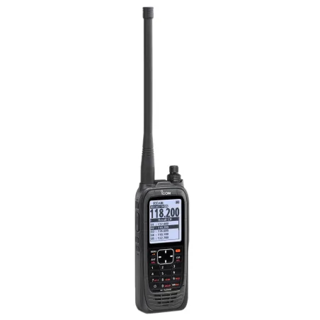
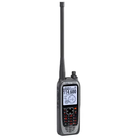
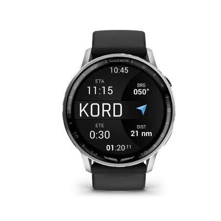
Focus on Garmin Aera 660 and 760 GPS
Portable GPS units are still a key tool for many pilots. Let’s take a closer look at the aera 660 and aera 760, two bestsellers in the general aviation world.
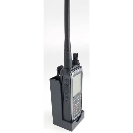
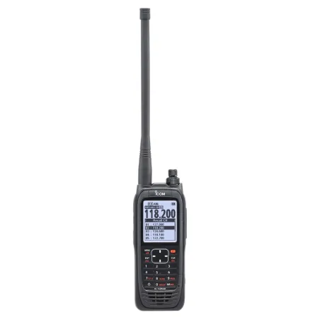
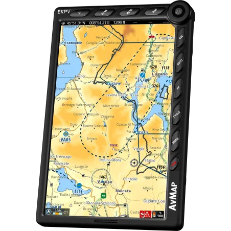
Garmin Aera 660: compact, intuitive
The aera 660 is a 5” portable GPS, ultra-compact but powerful. It provides moving map navigation, airspace alerts, flight plan management, and even compatibility with ADS-B for traffic and weather data (via a receiver such as the GDL 52). Its autonomy is around 4 hours, and it can be powered via the cigarette lighter or directly from the aircraft electrical system. Thanks to its size, it fits perfectly into small cockpits, microlights, or even as a backup GPS.
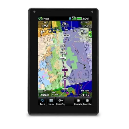
Garmin Aera 760: the reference in portable GPS
The aera 760 is the “flagship” of portable GPS units: a 7” screen, ultra-clear and responsive. It integrates advanced functions such as georeferenced charts, full IFR/VFR navigation (charts, procedures, approaches), ADS-B traffic and weather display, and even synthetic vision. It is clearly aimed at pilots who want a comprehensive GPS solution without investing in a fixed EFIS. It connects to most Garmin avionics, including transponders and radios, via Bluetooth or Wi-Fi. Autonomy is around 3.5 hours, with the same external power options as the 660.
Comparison table: Aera 660 vs Aera 760
|
Garmin Aera 660 |
Garmin Aera 760 |
|
|
Screen |
5” touchscreen |
7” touchscreen |
|
Main use |
VFR navigation, compact format |
Full VFR/IFR navigation, georeferenced charts |
|
Functions |
Maps, alerts, ADS-B compatibility |
Maps, alerts, ADS-B, IFR procedures, synthetic vision |
|
Battery life |
Approx. 4 hours |
Approx. 3.5 hours |
|
Target audience |
Pilots seeking a light, simple, affordable GPS |
Pilots wanting a comprehensive, professional GPS without EFIS |
EFIS vs GPS: which one should you choose?
Now that we’ve reviewed the main models, let’s summarize the differences between an EFIS and a GPS in a single table:
Comparison table: EFIS vs GPS
|
EFIS (G5 / G3X Touch) |
GPS (Aera 660 / 760) |
|
|
Main role |
Flight instruments (PFD/MFD) |
Navigation, maps, alerts |
|
Integration |
Fixed in the panel, connected to sensors |
Portable, removable |
|
Display |
Attitude, speed, altitude, heading, nav, engine |
Moving map, airspace, flight plans, traffic |
|
Target audience |
Pilots modernizing their cockpit or building new |
Pilots seeking a flexible, mobile tool |
|
Budget |
Higher (equipment + installation) |
More affordable, no installation needed |
Recommended configurations
To guide you better, here are some examples of configurations according to pilot profiles:
- For the beginner VFR pilot: Aera 660 → simple, effective, and portable.
- For the pilot who wants to modernize an old microlight: Garmin G5 + a portable GPS like the 660.
- For the pilot aiming for a “glass cockpit”: Garmin G3X Touch + integration with Garmin radios and transponders.
- For the IFR pilot: Aera 760 (as a backup) + a G3X Touch linked to a GNC 355 or GNX 375.
Conclusion
Choosing between an EFIS and a GPS isn’t about “which is better” but about “what do you really need.”
If you want to modernize your cockpit with reliable, integrated flight instruments, the EFIS is the obvious choice. If you want a flexible, portable navigation tool, the GPS will perfectly meet your needs. And for maximum safety, the two complement each other wonderfully: EFIS for instruments, GPS for navigation. Many pilots choose this “duo” to combine comfort, precision, and redundancy.
In any case, Garmin has developed a complete range that allows every pilot — beginner, experienced, VFR, or IFR — to find the solution suited to their flying style and budget.
Share this content
Add a comment