


Le Top 5 des applications d’aide à la navigation pour les pilotes
Categories :
BAYO
Aviation is constantly evolving and undergoing a digital transformation, whether in general aviation or commercial aviation. In fact, the global digital aviation market was valued at $39 billion in 2024, approaching the $40 billion mark, and is expected to grow by 40% over the next 10 years according to market outlooks. But why is this happening? The simple reason is that this evolution is driven by the continuous integration of digital technologies into flight operations with the goal of improving efficiency, safety, and the overall flight experience.
As a result, navigation apps play a crucial role in this revolution, offering pilots advanced tools related to flight planning, real-time monitoring, and access to up-to-date weather information. Yes, these features not only contribute to better accuracy throughout navigation, but also significantly simplify flight planning. The goal is clear: reduce pilots’ workload and increase operational safety. To give you an example: AI-based apps can analyze large data sets, providing personalized recommendations to pilots to help them choose what works best for them, such as identifying potential risks and finding optimal flight paths.
Today, we will make things easier for you by presenting the 5 best navigation apps that match your needs with a detailed analysis of the features, advantages, and disadvantages they offer, while comparing them so you can get a clear view and make an informed choice.
ForeFlight: The Reference App for Professionals
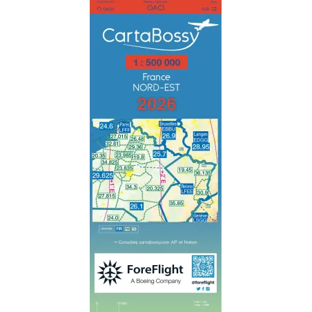
ForeFlight, more than just a navigation app, has become the gold standard for professional pilots, flight schools, and airlines. Its acquisition by Boeing is proof of its value: this tool is now one of the most comprehensive and sophisticated on the market. Upon opening the app, it’s easy to see why so many pilots can’t live without it. ForeFlight offers advanced flight planning, allowing pilots to create precise routes in just a few moments. Thanks to smart algorithms, it automatically calculates flight time, fuel consumption, and aircraft performance, taking into account weight, balance, and weather conditions. It’s a true pocket-sized control tower, making flying much safer. Speaking of weather, this unpredictable factor that can disrupt a flight in an instant, ForeFlight integrates live radar, high-resolution satellite imagery, and constantly updated METAR/TAF forecasts. Even better, it can predict turbulence zones, giving pilots a crucial advantage to anticipate flight conditions and adjust their route accordingly.
One of the most impressive features remains the 3D synthetic vision display, which revolutionizes the way pilots perceive their environment. Imagine an interactive view of the terrain, obstacles, and flight path, like being in an ultra-realistic simulator. Combined with the "Terrain Awareness" mode, which triggers alerts in case of proximity to the ground, this system greatly enhances flight safety. Not to mention that the app seamlessly integrates with modern avionics systems such as Garmin, ADS-B, Sentry, and Stratus, and automatically logs flight data in the virtual logbook in a precise and detailed manner. A valuable asset, both for tracking personal performance and for meeting regulatory requirements of airlines and flight schools.
The advantages:
✔️ Ultra-complete tool suited for professionals.
✔️ Ergonomic and intuitive interface.
✔️ Excellent integration with cockpit instruments.
The disadvantages:
❌ High price (annual subscription starting at €120).
❌ Some features require additional paid modules.
Garmin Pilot - The Perfect Ally for Garmin Users
Garmin Pilot has become a reference app, especially for users of Garmin systems. Designed to provide a seamless and integrated flight experience, it is the natural extension of Garmin equipment already found in many cockpits.
From the planning phase, Garmin Pilot stands out for its ability to provide comprehensive weather information, including interactive radar maps, satellite images, and detailed forecasts. This wealth of data allows pilots to make informed decisions before takeoff. The app also offers interactive maps and advanced navigation tools, facilitating flight preparation and execution.
One of the key strengths of Garmin Pilot lies in its seamless integration with Garmin avionics systems. This compatibility allows real-time synchronization of flight plans, navigation data, and critical information between the app and cockpit instruments, providing a smooth and cohesive user experience. Additionally, Garmin Pilot has recently enhanced its features by integrating Jeppesen VFR data, available in the standard version of the app. This update enables users to access high-quality European aeronautical information directly from the app.
For IFR pilots, the app offers powerful features, including enhanced flight planning tools and an optimized user interface, reminiscent of Garmin navigation systems like the GTN 750 or the G3000. These improvements make managing complex flight plans easier and enhance in-flight efficiency.
In short, Garmin Pilot is the perfect ally for pilots seeking deep integration with their Garmin avionics systems, offering a comprehensive suite of tools for a hassle-free flight experience.
The advantages:
✔️ Perfect for pilots using Garmin equipment.
✔️ Smooth and well-thought-out interface.
✔️ Advanced features for IFR flights.
The disadvantages:
❌ Fewer advanced planning tools compared to ForeFlight.
❌ Price similar to ForeFlight (starting at €100/year).
Airmate - The Best Free Alternative
Navigation tools can represent a significant investment, but Airmate stands out by offering a completely free alternative without compromising on quality or features. Designed to assist pilots in flight planning and flight tracking, this app proves to be a valuable companion for both VFR and IFR flights.
Airmate simplifies the process by allowing pilots to easily define their departure and arrival airports, either directly on an interactive aeronautical map or via a detailed planning form. Once this information is entered, the app automatically generates a complete navigation log, providing essential details such as the planned route, distances, headings, and estimated times.
In-flight, Airmate displays a dropdown map showing the aircraft's position, flight data, aeronautical and topographical information, and allows pilots to quickly access the latest NOTAM data and weather updates as well as approach charts for airports. The flight's trajectory and parameters are recorded and can later be reviewed and shared, for example, during a flight debrief.
The app will be available on iOS, Android, and via a web interface, offering great flexibility and adapting to each pilot's preferences. While the app is free, some specific charts, such as those from IGN or SIA, are paid. However, the app mainly relies on OpenStreetMap charts, which are royalty-free and ensure global map coverage without additional fees.
The advantages:
✔️ 100% free.
✔️ Easy to use, ideal for private pilots.
✔️ Available on iOS and Android.
The disadvantages:
❌ Fewer advanced features than ForeFlight or Garmin Pilot.
❌ Less suitable for IFR pilots.
SkyDemon - The Essential European App
SkyDemon has become an essential reference for European pilots. Specifically designed to meet the needs of aviators on the continent, this app offers a range of advanced features that make both flight planning and execution easier.
Indeed, SkyDemon is renowned for the clarity and precision provided by its dynamic vector maps, which allow for a detailed view of airspace, including updated information on controlled zones, temporary flight restrictions, and potential obstacles. Additionally, the "Virtual Radar" feature provides a cross-sectional view of the flight profile, helping pilots anticipate terrain variations and avoid high-risk areas.
For flight preparation, SkyDemon simplifies the process by offering intuitive route planning. Pilots can set their waypoints in just a few clicks, adjust their route based on weather conditions, and view detailed NOTAM briefings. The app also integrates real-time weather forecasts, overlaid on the main map, enabling a quick evaluation of en-route conditions, while also offering a detailed representation of runways and taxiways, which helps with approaches and taxiing phases.
Furthermore, the app is available on multiple platforms, including iOS, Android, PC, and Mac, and offers a 30-day free trial, after which a subscription will be required to continue using its services.
The advantages:
✔️ Very popular in Europe.
✔️ Intuitive and user-friendly interface.
✔️ Excellent airspace management.
The disadvantages:
❌ Less suitable for IFR flights.
❌ Paid (annual subscription around €150).
FlyQ EFB - The Underdog with Excellent Value for Money
For the last app in our top 5, FlyQ EFB by Seattle Avionics stands out for its excellent value for money, offering pilots a robust and affordable alternative. Its design aims to simplify and secure the flying experience, while integrating powerful features and maintaining an intuitive interface.
One of the key features of the app is undoubtedly its clear and simplified interface, designed to minimize in-flight manipulation, allowing pilots to focus entirely on their navigation without distractions.
Regarding weather, FlyQ EFB offers comprehensive and up-to-date data, including radar maps, satellite images, and detailed forecasts. Moreover, it is also compatible with a variety of ADS-B systems, such as the Stratus 3, Merlin, Stratux, and many others, giving pilots using different equipment valuable flexibility.
Overall, FlyQ EFB positions itself as a solid option for pilots looking for a high-performance, affordable aviation navigation app, combining a user-friendly interface with advanced features.
The advantages:
✔️ Clear and easy-to-use interface.
✔️ Advanced features without being overly complex.
✔️ Cheaper than ForeFlight and Garmin Pilot.
The disadvantages:
❌ Fewer integrations than ForeFlight.
❌ Smaller user community.
Comparison Table of These 5 Apps
| Applications | Advanced Weather | Flight Planning | 3D Maps | Avionics Compatibility | Price |
|---|---|---|---|---|---|
| ForeFlight | YES | Very comprehensive | YES | Garmin, ADS-B | €€€ |
| Garmin Pilot | YES | Comprehensive | YES | Garmin | €€ |
| AirMate | Basic | Simple | Basic | Limited | Free |
| SkyDemon | YES | Simple | YES | NO | €€ |
| FlyQ EFB | YES | Medium | YES | ADS-B (Merlin, Stratux…) | €€ |
In Summary
- ForeFlight is the most comprehensive but also the most expensive.
- Garmin Pilot is ideal for those using Garmin instruments.
- AirMate is completely free but has less powerful and diverse features.
- SkyDemon is the perfect tool for Europeans.
- FlyQ EFB strikes a good balance between price and features.
Which app to choose based on your pilot profile?
If you are a professional pilot or a flight training center, you can opt for ForeFlight or Garmin Pilot. However, for private VFR pilots looking for an affordable solution, two options are available: AirMate or SkyDemon. Of course, for pilots who have chosen a complete Garmin setup, Garmin Pilot is the way to go. European pilots, who usually have medium or long-haul flights, will find SkyDemon to be the best app. Finally, for those seeking a solution with excellent value for money, FlyQ EFB is a great option.
In conclusion, aviation navigation apps have profoundly transformed how pilots prepare and execute their flights, providing powerful tools to ensure safety, accuracy, and efficiency. Whether you're a professional looking for a comprehensive solution like ForeFlight, a Garmin system enthusiast with Garmin Pilot, a private pilot searching for a free yet effective option like AirMate, or a European user prioritizing detailed maps with SkyDemon, each app has its specific strengths.
The choice of application will depend on each pilot’s particular needs, preferences in avionics systems, desired geographical coverage, and budget. Rest assured, all of these apps are functional and do not have significant technical flaws. However, we recommend you try these apps before committing to a subscription. Most of these navigation assistance apps offer a 30-day trial phase, allowing you to get familiar with the app and see if it fits your flying style. In any case, these modern tools enhance flight safety and enable simplified navigation, ensuring a smoother and more relaxed experience for aviators.
And you? Which app do you use for assistance? Let us know on our social media!
Share this content
Add a comment